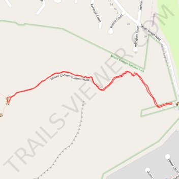
Mount Coolum Summit Walk
- Distance: 1.1 mi
- Elevation gain: 178 m
- Maximum elevation: 191 m
- Elevation loss: 178 m
- Minimum elevation: 13 m
- Moving time: 35 m 2 s
- Moving speed: 1.9 mph
- Maximum speed: 3.6 mph
- Total time: 35 m 2 s
- Global speed: 1.9 mph
Interactive trail map
Trail profile
- Distance: 1.1 mi
- Elevation gain: 178 m
- Maximum elevation: 191 m
- Elevation loss: 178 m
- Minimum elevation: 13 m
- Moving time: 35 m 2 s
- Moving speed: 1.9 mph
- Maximum speed: 3.6 mph
- Total time: 35 m 2 s
- Global speed: 1.9 mph
About this trail
Name: Mount Coolum Summit Walk trail, distance, elevation, map, profile, GPS track
Coordinates: -26.56182 153.08421 -26.56053 153.09078