Import a GPX file

AC/DC New Trails To Explore

  • Distance: 6.4 mi
  • Elevation gain: 167 m
  • Maximum elevation: 1,609 m
  • Elevation loss: 168 m
  • Minimum elevation: 1,495 m
  • Moving time: 58 m 43 s
  • Moving speed: 6.5 mph
  • Maximum speed: 23.9 mph
  • Total time: 1 h 8 m
  • Global speed: 5.6 mph

Interactive trail map

Trail profile

  • Distance: 6.4 mi
  • Elevation gain: 167 m
  • Maximum elevation: 1,609 m
  • Elevation loss: 168 m
  • Minimum elevation: 1,495 m
  • Moving time: 58 m 43 s
  • Moving speed: 6.5 mph
  • Maximum speed: 23.9 mph
  • Total time: 1 h 8 m
  • Global speed: 5.6 mph

About this trail

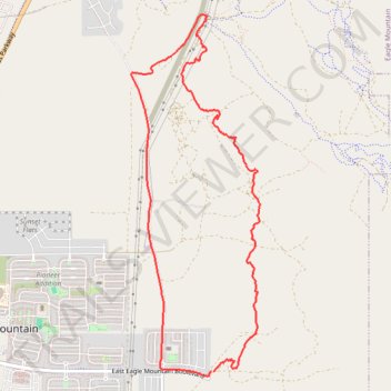
Name: AC/DC New Trails To Explore trail, distance, elevation, map, profile, GPS track

Start: East Eagle Mountain Boulevard, Eagle Mountain, Utah County, Utah, 84005, United States (40.30537 -111.98603)

End: East Eagle Mountain Boulevard, Eagle Mountain, Utah County, Utah, 84005, United States (40.30536 -111.98624)

Coordinates: 40.30489 -111.99595 40.33827 -111.98037

Gear up for your next adventure:

🧰Survival Kits - Emergency tools for remote environments
🔭Compact Hiking Binoculars - Lightweight optics for scouting terrain and spotting wildlife
📦Dry Bags - Waterproof bags to protect gear from rain
📷Camera Straps - Secure straps for carrying cameras while walking
🔦LED Camping Lanterns - Illumination for reading maps inside your tent at night

As an Amazon Associate, this site earns from qualifying purchases at no extra cost to you.