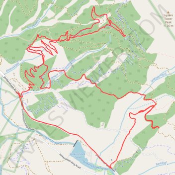
Jonkershoek Nature Reserve
- Distance: 9.6 mi
- Elevation gain: 759 m
- Maximum elevation: 611 m
- Elevation loss: 756 m
- Minimum elevation: 240 m
- Moving time: 1 h 55 m
- Moving speed: 5.0 mph
- Maximum speed: 28.7 mph
- Total time: 2 h 13 m
- Global speed: 4.3 mph
Interactive trail map
Trail profile
- Distance: 9.6 mi
- Elevation gain: 759 m
- Maximum elevation: 611 m
- Elevation loss: 756 m
- Minimum elevation: 240 m
- Moving time: 1 h 55 m
- Moving speed: 5.0 mph
- Maximum speed: 28.7 mph
- Total time: 2 h 13 m
- Global speed: 4.3 mph
About this trail
Name: Jonkershoek Nature Reserve trail, distance, elevation, map, profile, GPS track
Coordinates: -33.97770 18.93426 -33.95795 18.95531