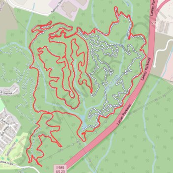
Chicopee Woods MTB Loop
Interactive trail map
Trail profile
- Distance: 10.9 mi
- Elevation gain: 377 m
- Maximum elevation: 387 m
- Elevation loss: 377 m
- Minimum elevation: 324 m
- Moving time: 1 h 23 m
- Moving speed: 7.8 mph
- Maximum speed: 28.4 mph
- Total time: 1 h 23 m
- Global speed: 7.8 mph
About this trail
Name: Chicopee Woods MTB Loop trail, distance, elevation, map, profile, GPS track
Coordinates: 34.24792 -83.83758 34.26491 -83.82221