Nant Gwyn
- Distance: 7.2 mi
- Elevation gain: 396 m
- Maximum elevation: 439 m
- Elevation loss: 404 m
- Minimum elevation: 198 m
- Moving time: 4 h 28 s
- Moving speed: 1.8 mph
- Maximum speed: 5.5 mph
- Total time: 4 h 53 m
- Global speed: 1.5 mph
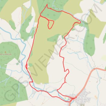
Interactive trail map
Trail profile
- Distance: 7.2 mi
- Elevation gain: 396 m
- Maximum elevation: 439 m
- Elevation loss: 404 m
- Minimum elevation: 198 m
- Moving time: 4 h 28 s
- Moving speed: 1.8 mph
- Maximum speed: 5.5 mph
- Total time: 4 h 53 m
- Global speed: 1.5 mph
About this trail
Name: Nant Gwyn trail, distance, elevation, map, profile, GPS track
Start: Llanwrtyd Wells, Powys, Wales, LD5 4TL, United Kingdom (52.11503 -3.65748)
End: Llanwrtyd Wells, Powys, Wales, LD5 4SY, United Kingdom (52.11534 -3.65806)
Coordinates: 52.10644 -3.65848 52.13158 -3.63526
Topography: Powys topographic map, elevation, terrain
Other hiking, mountain biking, running and outdoor activity trails
Click on a trail to view its statistics, map and profile.
The Headstock 500
United Kingdom > Wales > Newport > Newport
Distance: 300.4 mi • Elevation gain: 9,616 m • Maximum elevation: 691 m
Irfon Forest
United Kingdom > Wales > Powys > Llanwrtyd Wells
Distance: 9.1 mi • Elevation gain: 456 m • Maximum elevation: 480 m