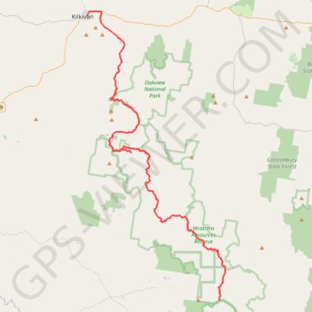
Track Kilkivan towards Kandanga
- Distance: 42.4 mi
- Elevation gain: 1,770 m
- Maximum elevation: 703 m
- Elevation loss: 1,303 m
- Minimum elevation: 122 m
Interactive trail map
Trail profile
- Distance: 42.4 mi
- Elevation gain: 1,770 m
- Maximum elevation: 703 m
- Elevation loss: 1,303 m
- Minimum elevation: 122 m
About this trail
Name: Track Kilkivan towards Kandanga trail, distance, elevation, map, profile, GPS track
Start: Council Street, Kilkivan, Gympie Regional, Queensland, Australia (-26.08526 152.24214)
End: Wrattens Kandanga Road, Upper Kandanga, Gympie Regional, Queensland, Australia (-26.40216 152.40762)
Coordinates: -26.40216 152.24211 -26.08035 152.41464
Other hiking, mountain biking, running and outdoor activity trails
Click on a trail to view its statistics, map and profile.
Imbil Jimna Kenilworth loop
Australia > Queensland > Tewantin
Distance: 134.2 mi • Elevation gain: 3,884 m • Maximum elevation: 822 m
Manumbar and Elgin Vale
Barambah, Manumbar, Elgin Vale, Queensland
Distance: 30.5 mi • Elevation gain: 791 m • Maximum elevation: 515 m
Kandanga Wrattens Widgee Loop
Australia > Queensland > Tewantin
Distance: 136.9 mi • Elevation gain: 3,584 m • Maximum elevation: 684 m