Import a GPX file

Hot Spring Canyon Falls

Hike to Hot Spring Canyon Falls in the Cleveland National Forest. #Hiking #Falls #Canyon #Nature #Forest #River

  • Distance: 1.5 mi
  • Elevation gain: 25 m
  • Maximum elevation: 1,013 m
  • Elevation loss: 145 m
  • Minimum elevation: 889 m

Interactive trail map

Trail profile

  • Distance: 1.5 mi
  • Elevation gain: 25 m
  • Maximum elevation: 1,013 m
  • Elevation loss: 145 m
  • Minimum elevation: 889 m

About this trail
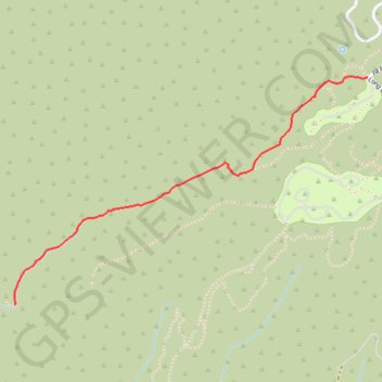
Name: Hot Spring Canyon Falls trail, distance, elevation, map, profile, GPS track

Start: Falcon Group Campsite, Long Canyon Road, Orange County, California, 90000, United States (33.65775 -117.45092)

End: Orange County, California, United States (33.64735 -117.47030)

Coordinates: 33.64735 -117.47030 33.65778 -117.45092

Gear up for your next adventure:

🥾Hiking Boot Waterproofing Wax - Maintain the lifespan of your leather trekking boots
🧴Sport Sunscreen Sticks - High-protection sunblock that won't run into your eyes on the trail
🛌Sleeping Bags - Warm and packable sleeping bags for outdoor nights
🔦Head Torches - Hands-free lighting for hiking and camping
🗺️Ordnance Survey Maps - Essential paper maps for hiking across the UK national parks

As an Amazon Associate, this site earns from qualifying purchases at no extra cost to you.