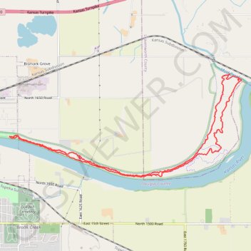
Kansas River MTB Loop
Mountain Bike loop along the Kansas River in Lawrence River Trails. #MTB #Loop #River #Forest #Nature
- Distance: 8.7 mi
- Elevation gain: 94 m
- Maximum elevation: 257 m
- Elevation loss: 94 m
- Minimum elevation: 245 m
- Moving time: 6 h 30 m
- Moving speed: 1.3 mph
- Maximum speed: 1.7 mph
- Total time: 1 d 17 h
- Global speed: 0.2 mph
Interactive trail map
Trail profile
- Distance: 8.7 mi
- Elevation gain: 94 m
- Maximum elevation: 257 m
- Elevation loss: 94 m
- Minimum elevation: 245 m
- Moving time: 6 h 30 m
- Moving speed: 1.3 mph
- Maximum speed: 1.7 mph
- Total time: 1 d 17 h
- Global speed: 0.2 mph
About this trail
Name: Kansas River MTB Loop trail, distance, elevation, map, profile, GPS track
Coordinates: 38.96497 -95.21610 38.98283 -95.16413