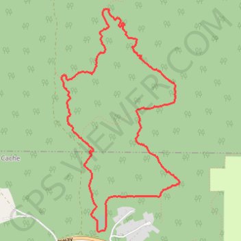
El Grande Norte Loop
- Distance: 3.9 mi
- Elevation gain: 460 m
- Maximum elevation: 1,651 m
- Elevation loss: 459 m
- Minimum elevation: 1,213 m
- Moving time: 1 h 18 m
- Moving speed: 3.0 mph
- Maximum speed: 8.1 mph
- Total time: 1 h 19 m
- Global speed: 2.9 mph
Interactive trail map
Trail profile
- Distance: 3.9 mi
- Elevation gain: 460 m
- Maximum elevation: 1,651 m
- Elevation loss: 459 m
- Minimum elevation: 1,213 m
- Moving time: 1 h 18 m
- Moving speed: 3.0 mph
- Maximum speed: 8.1 mph
- Total time: 1 h 19 m
- Global speed: 2.9 mph
About this trail
Name: El Grande Norte Loop trail, distance, elevation, map, profile, GPS track
Coordinates: 53.89905 -119.13010 53.91581 -119.11506
Other hiking, mountain biking, running and outdoor activity trails
Click on a trail to view its statistics, map and profile.
La Petite Grande
Canada > Alberta > Municipal District of Greenview > Hamlet of Grande Cache
Afternoon Trail Run
Distance: 4.6 mi • Elevation gain: 445 m • Maximum elevation: 1,648 m