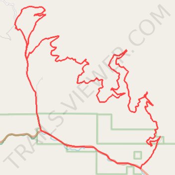
Bear Creek / Grave Creek Loop
- Distance: 32.3 mi
- Elevation gain: 1,515 m
- Maximum elevation: 1,887 m
- Elevation loss: 1,521 m
- Minimum elevation: 1,112 m
- Moving time: 3 h 42 m
- Moving speed: 8.7 mph
- Maximum speed: 28.7 mph
- Total time: 4 h 14 m
- Global speed: 7.6 mph
Interactive trail map
Trail profile
- Distance: 32.3 mi
- Elevation gain: 1,515 m
- Maximum elevation: 1,887 m
- Elevation loss: 1,521 m
- Minimum elevation: 1,112 m
- Moving time: 3 h 42 m
- Moving speed: 8.7 mph
- Maximum speed: 28.7 mph
- Total time: 4 h 14 m
- Global speed: 7.6 mph
About this trail
Name: Bear Creek / Grave Creek Loop trail, distance, elevation, map, profile, GPS track
Start: Bear Creek Road, Missoula County, Montana, United States (46.76839 -114.32376)
End: Bear Creek Road, Missoula County, Montana, United States (46.76825 -114.32368)
Coordinates: 46.76430 -114.41816 46.84281 -114.31521