
Sugarloaf loop
- Distance: 6.5 mi
- Elevation gain: 514 m
- Maximum elevation: 582 m
- Elevation loss: 514 m
- Minimum elevation: 77 m
Interactive trail map
Trail profile
- Distance: 6.5 mi
- Elevation gain: 514 m
- Maximum elevation: 582 m
- Elevation loss: 514 m
- Minimum elevation: 77 m
About this trail
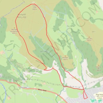
Name: Sugarloaf loop trail, distance, elevation, map, profile, GPS track
Start: Chapel Lane, Abergavenny, Monmouthshire, Wales, NP7 7BT, United Kingdom (51.83067 -3.02855)
End: Chapel Lane, Abergavenny, Monmouthshire, Wales, NP7 7BT, United Kingdom (51.83067 -3.02854)
Coordinates: 51.82965 -3.06857 51.86272 -3.02808
Topography: Monmouthshire topographic map, elevation, terrain
Other hiking, mountain biking, running and outdoor activity trails
Click on a trail to view its statistics, map and profile.
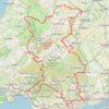
The Headstock 500
United Kingdom > Wales > Newport > Newport
Distance: 300.4 mi • Elevation gain: 9,616 m • Maximum elevation: 691 m