
Te Ahua Point via Mercer Bay Loop Track
- Distance: 1.4 mi
- Elevation gain: 285 m
- Maximum elevation: 255 m
- Elevation loss: 281 m
- Minimum elevation: 28 m
- Moving time: 35 m 33 s
- Moving speed: 2.4 mph
- Maximum speed: 4.5 mph
- Total time: 1 h 8 m
- Global speed: 1.2 mph
Interactive trail map
Trail profile
- Distance: 1.4 mi
- Elevation gain: 285 m
- Maximum elevation: 255 m
- Elevation loss: 281 m
- Minimum elevation: 28 m
- Moving time: 35 m 33 s
- Moving speed: 2.4 mph
- Maximum speed: 4.5 mph
- Total time: 1 h 8 m
- Global speed: 1.2 mph
About this trail
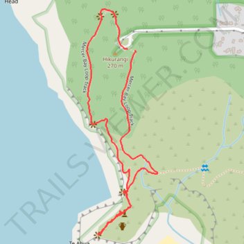
Name: Te Ahua Point via Mercer Bay Loop Track trail, distance, elevation, map, profile, GPS track
Start: Mercer Bay Loop Track, Piha, Waitākere Ranges, Auckland, 0772, New Zealand (-36.97030 174.46846)
End: Log Race Road, Piha, Waitākere Ranges, Auckland, 0772, New Zealand (-36.97025 174.46816)
Coordinates: -36.97604 174.46658 -36.96901 174.46931