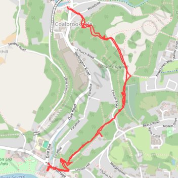
Coalbrookdale to the Rotunda
- Distance: 3.0 mi
- Elevation gain: 185 m
- Maximum elevation: 150 m
- Elevation loss: 185 m
- Minimum elevation: 45 m
- Moving time: 1 h 15 m
- Moving speed: 2.4 mph
- Maximum speed: 7.4 mph
- Total time: 1 h 41 m
- Global speed: 1.8 mph
Interactive trail map
Trail profile
- Distance: 3.0 mi
- Elevation gain: 185 m
- Maximum elevation: 150 m
- Elevation loss: 185 m
- Minimum elevation: 45 m
- Moving time: 1 h 15 m
- Moving speed: 2.4 mph
- Maximum speed: 7.4 mph
- Total time: 1 h 41 m
- Global speed: 1.8 mph
About this trail
Name: Coalbrookdale to the Rotunda trail, distance, elevation, map, profile, GPS track
Coordinates: 52.62988 -2.49406 52.64082 -2.48481
Topography: Telford and Wrekin topographic map, elevation, terrain