Wilsch Walk
Interactive trail map
Trail profile
- Distance: 3.0 mi
- Elevation gain: 157 m
- Maximum elevation: 51 m
- Elevation loss: 157 m
- Minimum elevation: 6 m
About this trail
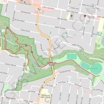
Name: Wilsch Walk trail, distance, elevation, map, profile, GPS track
Coordinates: -33.81832 151.20627 -33.81319 151.21849
Other hiking, mountain biking, running and outdoor activity trails
Click on a trail to view its statistics, map and profile.