Import a GPX file

Bump Track

Mowbray National Park. #Hiking #MTB #Mowbray

  • Distance: 7.5 mi
  • Elevation gain: 427 m
  • Maximum elevation: 393 m
  • Elevation loss: 427 m
  • Minimum elevation: 25 m

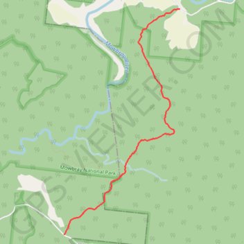
Interactive trail map

Trail profile

  • Distance: 7.5 mi
  • Elevation gain: 427 m
  • Maximum elevation: 393 m
  • Elevation loss: 427 m
  • Minimum elevation: 25 m

About this trail

Name: Bump Track trail, distance, elevation, map, profile, GPS track

Start: Connolly Road, Mowbray, Douglas Shire, Queensland, Australia (-16.56653 145.45443)

End: Connolly Road, Mowbray, Douglas Shire, Queensland, Australia (-16.56653 145.45443)

Coordinates: -16.60275 145.43502 -16.56653 145.45443

Gear up for your next adventure:

🧺Microfibre Travel Towels - Fast-drying and compact towels for wild swimming and camping
🧤Waterproof Overmitts - Extreme weather protection for hikers and mountaineers
📷Camera Straps - Secure straps for carrying cameras while walking
👟Men's Trail Running Shoes - Lightweight grip for fast movement over topographic contours
📐Altimeters & Barometers - Tools for measuring altitude and air pressure

As an Amazon Associate, this site earns from qualifying purchases at no extra cost to you.