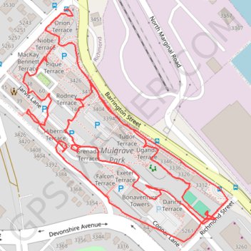
Mulgrave park on foot
- Distance: 1.4 mi
- Elevation gain: 50 m
- Maximum elevation: 41 m
- Elevation loss: 52 m
- Minimum elevation: 14 m
- Moving time: 34 m 43 s
- Moving speed: 2.4 mph
- Maximum speed: 11.5 mph
- Total time: 47 m 49 s
- Global speed: 1.8 mph
Interactive trail map
Trail profile
- Distance: 1.4 mi
- Elevation gain: 50 m
- Maximum elevation: 41 m
- Elevation loss: 52 m
- Minimum elevation: 14 m
- Moving time: 34 m 43 s
- Moving speed: 2.4 mph
- Maximum speed: 11.5 mph
- Total time: 47 m 49 s
- Global speed: 1.8 mph
About this trail
Name: Mulgrave park on foot trail, distance, elevation, map, profile, GPS track
Coordinates: 44.66723 -63.60272 44.67055 -63.59862
Other hiking, mountain biking, running and outdoor activity trails
Click on a trail to view its statistics, map and profile.
Halifax - Upper Sackville
Canada > Nova Scotia > Halifax County > Halifax
#Bike #Halifax #UpperSackville
Distance: 21.9 mi • Elevation gain: 396 m • Maximum elevation: 138 m
Brookfield - Halifax
Canada > Nova Scotia > Municipality of Colchester > Brookfield
Distance: 57.3 mi • Elevation gain: 658 m • Maximum elevation: 66 m