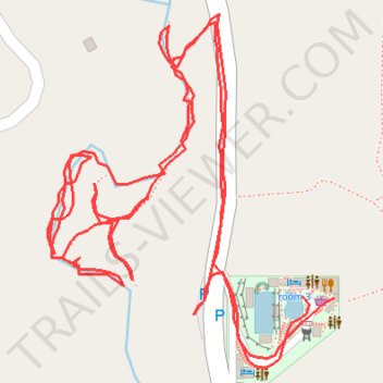
Philippines Cebu Liloan Little Santorino River Walk
- Distance: 1.0 mi
- Elevation gain: 41 m
- Maximum elevation: 86 m
- Elevation loss: 48 m
- Minimum elevation: 47 m
- Moving time: 39 m 19 s
- Moving speed: 1.5 mph
- Maximum speed: 7.5 mph
- Total time: 1 h 44 s
- Global speed: 1.0 mph
Interactive trail map
Trail profile
- Distance: 1.0 mi
- Elevation gain: 41 m
- Maximum elevation: 86 m
- Elevation loss: 48 m
- Minimum elevation: 47 m
- Moving time: 39 m 19 s
- Moving speed: 1.5 mph
- Maximum speed: 7.5 mph
- Total time: 1 h 44 s
- Global speed: 1.0 mph
About this trail
Name: Philippines Cebu Liloan Little Santorino River Walk trail, distance, elevation, map, profile, GPS track
Start: Bajac Road, Babaw, Lataban, Cebu, Central Visayas, 6002, Philippines (10.42574 123.95926)
End: room 2, Bajac Road, Babaw, Lataban, Cebu, Central Visayas, 6002, Philippines (10.42575 123.95908)
Coordinates: 10.42536 123.95767 10.42729 123.95926