Import a GPX file

Bits of Tipporogoree MTB Trails

Loop MTB in the Tipporogoree Hills Conservation Area. #MTB #Loop #Nature #Forest

  • Distance: 9.7 mi
  • Elevation gain: 411 m
  • Maximum elevation: 329 m
  • Elevation loss: 412 m
  • Minimum elevation: 28 m
  • Moving time: 1 h 40 m
  • Moving speed: 5.8 mph
  • Maximum speed: 18.2 mph
  • Total time: 2 h 3 m
  • Global speed: 4.7 mph

Interactive trail map

Trail profile

  • Distance: 9.7 mi
  • Elevation gain: 411 m
  • Maximum elevation: 329 m
  • Elevation loss: 412 m
  • Minimum elevation: 28 m
  • Moving time: 1 h 40 m
  • Moving speed: 5.8 mph
  • Maximum speed: 18.2 mph
  • Total time: 2 h 3 m
  • Global speed: 4.7 mph

About this trail

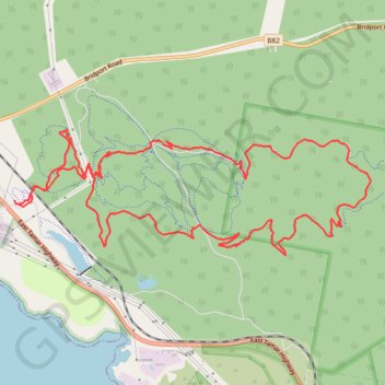
Name: Bits of Tipporogoree MTB Trails trail, distance, elevation, map, profile, GPS track

Start: Switchplate, Bell Bay, George Town, Tasmania, 7253, Australia (-41.12588 146.88770)

End: Switchplate, Bell Bay, George Town, Tasmania, 7253, Australia (-41.12557 146.88753)

Coordinates: -41.13065 146.88749 -41.11903 146.93108

Gear up for your next adventure:

📍Handheld GPS Navigators - Reliable satellite navigation for hiking and off-road exploration
🧥Packable Down Jackets - Lightweight warmth that compresses small in your bag
👕Merino Base Layers - Natural temperature regulation for cold weather hiking and camping
🩹Hiking First Aid Kits - Compact medical kits tailored for trail injuries and emergencies
📻Hand-Crank Emergency Radios - Stay updated on weather warnings in remote areas

As an Amazon Associate, this site earns from qualifying purchases at no extra cost to you.