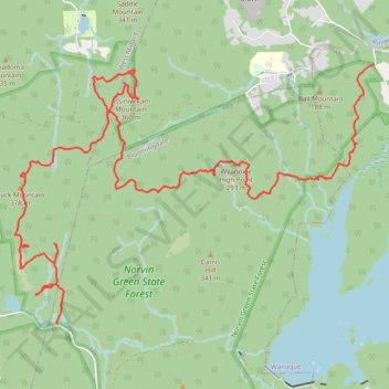
Norvin Green State Forest Hike
- Distance: 9.2 mi
- Elevation gain: 393 m
- Maximum elevation: 369 m
- Elevation loss: 537 m
- Minimum elevation: 114 m
- Moving time: 4 h 30 m
- Moving speed: 2.0 mph
- Maximum speed: 6.8 mph
- Total time: 6 h 26 m
- Global speed: 1.4 mph
Interactive trail map
Trail profile
- Distance: 9.2 mi
- Elevation gain: 393 m
- Maximum elevation: 369 m
- Elevation loss: 537 m
- Minimum elevation: 114 m
- Moving time: 4 h 30 m
- Moving speed: 2.0 mph
- Maximum speed: 6.8 mph
- Total time: 6 h 26 m
- Global speed: 1.4 mph
About this trail
Name: Norvin Green State Forest Hike trail, distance, elevation, map, profile, GPS track
Coordinates: 41.04583 -74.35552 41.07050 -74.31022