Thank you for supporting this site ❤️
Make a donation
Make a donation
Gear up for your next adventure:
As an Amazon Associate, this site earns from qualifying purchases at no extra cost to you.
Cycle on quiet back roads between Woodburn and Ballina (ferry)
- Distance: 22.5 mi
- Elevation gain: 160 m
- Maximum elevation: 19 m
- Elevation loss: 160 m
- Minimum elevation: 0 m
- Moving time: 1 h 52 m
- Moving speed: 12.0 mph
- Maximum speed: 23.8 mph
- Total time: 1 h 54 m
- Global speed: 11.7 mph
Interactive trail map
Thank you for supporting this site ❤️
Make a donation
Make a donation
Gear up for your next adventure:
As an Amazon Associate, this site earns from qualifying purchases at no extra cost to you.
Trail profile
- Distance: 22.5 mi
- Elevation gain: 160 m
- Maximum elevation: 19 m
- Elevation loss: 160 m
- Minimum elevation: 0 m
- Moving time: 1 h 52 m
- Moving speed: 12.0 mph
- Maximum speed: 23.8 mph
- Total time: 1 h 54 m
- Global speed: 11.7 mph
Thank you for supporting this site ❤️
Make a donation
Make a donation
Gear up for your next adventure:
As an Amazon Associate, this site earns from qualifying purchases at no extra cost to you.
About this trail
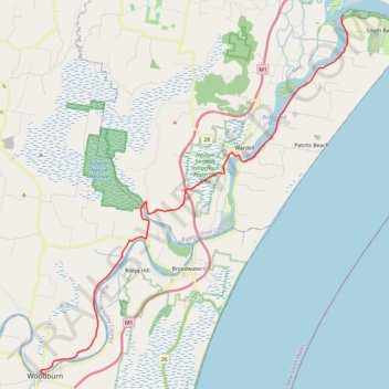
Name: Cycle on quiet back roads between Woodburn and Ballina (ferry) trail, distance, elevation, map, profile, GPS track
Coordinates: -29.07189 153.34162 -28.87620 153.53189
Thank you for supporting this site ❤️
Make a donation
Make a donation
Gear up for your next adventure:
As an Amazon Associate, this site earns from qualifying purchases at no extra cost to you.