Ouzel Falls, Calypso Cascades and Copeland Falls via Wild Basin Trail
The Wild Basin Trail in Rocky Mountain National Park offers hikers a scenic journey through lush forests alongside the melodious North St. Vrain Creek. Early in the hike, visitors encounter the tranquil beauty of Copeland Falls, followed by the impressive Calypso Cascades, where water tumbles gracefully over a series of rocks. The trail culminates at Ouzel Falls, a stunning 40-foot waterfall that rewards hikers with its refreshing mist and picturesque surroundings. #Hiking #Waterfall #River #Forest #Mountain #Nature
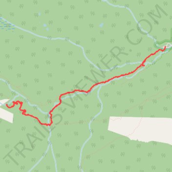
- Distance: 5.7 mi
- Elevation gain: 337 m
- Maximum elevation: 2,868 m
- Elevation loss: 337 m
- Minimum elevation: 2,592 m
- Moving time: 2 h 39 m
- Moving speed: 2.1 mph
- Maximum speed: 6.2 mph
- Total time: 4 h 53 m
- Global speed: 1.2 mph
Interactive trail map
Trail profile
- Distance: 5.7 mi
- Elevation gain: 337 m
- Maximum elevation: 2,868 m
- Elevation loss: 337 m
- Minimum elevation: 2,592 m
- Moving time: 2 h 39 m
- Moving speed: 2.1 mph
- Maximum speed: 6.2 mph
- Total time: 4 h 53 m
- Global speed: 1.2 mph
About this trail
Name: Ouzel Falls, Calypso Cascades and Copeland Falls via Wild Basin Trail trail, distance, elevation, map, profile, GPS track
End: County Highway 115, Boulder County, Colorado, 80510, United States (40.20801 -105.56647)
Coordinates: 40.19548 -105.59962 40.20803 -105.56645
Other hiking, mountain biking, running and outdoor activity trails
Click on a trail to view its statistics, map and profile.