Import a GPX file

Edgemere East Beach

  • Distance: 1.4 mi
  • Elevation gain: 15 m
  • Maximum elevation: 5 m
  • Elevation loss: 15 m
  • Minimum elevation: -2 m
  • Moving time: 16 m 37 s
  • Moving speed: 5.0 mph
  • Maximum speed: 16.1 mph
  • Total time: 21 m 1 s
  • Global speed: 3.9 mph

Interactive trail map

Trail profile

  • Distance: 1.4 mi
  • Elevation gain: 15 m
  • Maximum elevation: 5 m
  • Elevation loss: 15 m
  • Minimum elevation: -2 m
  • Moving time: 16 m 37 s
  • Moving speed: 5.0 mph
  • Maximum speed: 16.1 mph
  • Total time: 21 m 1 s
  • Global speed: 3.9 mph

About this trail

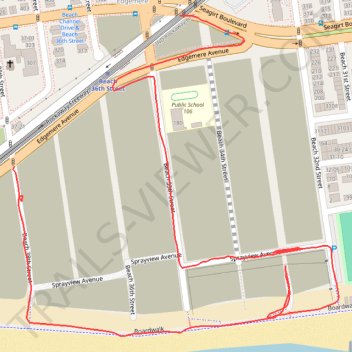
Name: Edgemere East Beach trail, distance, elevation, map, profile, GPS track

Start: Rockaway Freeway, Edgemere, Queens, Queens County, New York, 11691, United States (40.59614 -73.76697)

End: Beach 38th Street, Edgemere, Queens, Queens County, New York, 11691, United States (40.59391 -73.77020)

Coordinates: 40.59139 -73.77023 40.59614 -73.76387

Gear up for your next adventure:

🚲Bikepacking Frame Bags - Storage for tools and navigation gear on long off-road rides
🌄Compact Monoculars - Lightweight optics for hiking
🔦Waterproof LED Headlamps - Hands-free lighting for evening treks and emergency navigation
🧭Professional Hiking Compasses - High-precision liquid-filled compasses for map reading and orientation
🧗Locking Carabiners - Secure gear to your pack or for light technical use

As an Amazon Associate, this site earns from qualifying purchases at no extra cost to you.