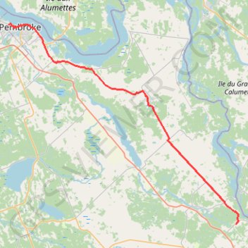
Import a GPX file

Pembroke - Renfrew

#Bike #Pembroke #Renfrew

  • Distance: 33.7 mi
  • Elevation gain: 258 m
  • Maximum elevation: 175 m
  • Elevation loss: 207 m
  • Minimum elevation: 111 m

Interactive trail map

Trail profile

  • Distance: 33.7 mi
  • Elevation gain: 258 m
  • Maximum elevation: 175 m
  • Elevation loss: 207 m
  • Minimum elevation: 111 m

About this trail

Other hiking, mountain biking, running and outdoor activity trails

Click on a trail to view its statistics, map and profile.

Québec - Montréal - Saint-Laurent River - Lake Ontario - Niagara Falls

Canada > Quebec > Urban agglomeration of Québec > Quebec

#Bike #Ontario

Distance: 670.1 mi • Elevation gain: 4,804 m • Maximum elevation: 209 m

Gear up for your next adventure:

📱Phone Mounts for Hiking - Secure mounts to carry your phone on trails
🦟Anti-Midge & Tick Repellent - Vital for hiking in the Scottish Highlands during summer
🪢Paracord - Multi-purpose cord for camping and survival
🧰Survival Kits - Emergency tools for remote environments
🖼️Topographic Map Art - Decorative 3D-effect posters of famous UK peaks and regions

As an Amazon Associate, this site earns from qualifying purchases at no extra cost to you.