Sweetwater Creek State Park Loop
Loop hike in Sweetwater Creek State Park via Red Trail, Sweetwater Creek and White Trail. #Hiking #Loop #Nature #Forest #River #Park
- Distance: 3.1 mi
- Elevation gain: 144 m
- Maximum elevation: 298 m
- Elevation loss: 145 m
- Minimum elevation: 240 m
- Moving time: 2 h 6 m
- Moving speed: 1.5 mph
- Maximum speed: 2.7 mph
- Total time: 3 h 10 m
- Global speed: 1.0 mph
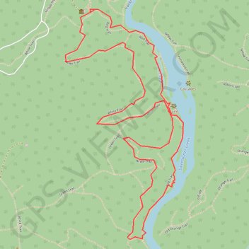
Interactive trail map
Trail profile
- Distance: 3.1 mi
- Elevation gain: 144 m
- Maximum elevation: 298 m
- Elevation loss: 145 m
- Minimum elevation: 240 m
- Moving time: 2 h 6 m
- Moving speed: 1.5 mph
- Maximum speed: 2.7 mph
- Total time: 3 h 10 m
- Global speed: 1.0 mph
About this trail
Name: Sweetwater Creek State Park Loop trail, distance, elevation, map, profile, GPS track
Start: Red Trail, Douglas County, Georgia, 30122, United States (33.75251 -84.62830)
End: Red Trail, Douglas County, Georgia, 30122, United States (33.75258 -84.62806)
Coordinates: 33.74135 -84.62976 33.75262 -84.62282
Other hiking, mountain biking, running and outdoor activity trails
Click on a trail to view its statistics, map and profile.
Powder Springs, Allatoona trails, Dallas, Chatt Hills
United States > Georgia > Fayette County > Tyrone > Stop
Distance: 198.6 mi • Elevation gain: 3,805 m • Maximum elevation: 379 m