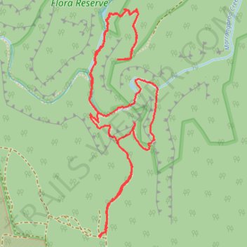
Lost City Walking Track
- Distance: 3.8 mi
- Elevation gain: 273 m
- Maximum elevation: 1,134 m
- Elevation loss: 273 m
- Minimum elevation: 996 m
- Moving time: 1 h 37 m
- Moving speed: 2.3 mph
- Maximum speed: 5.0 mph
- Total time: 1 h 54 m
- Global speed: 2.0 mph
Interactive trail map
Trail profile
- Distance: 3.8 mi
- Elevation gain: 273 m
- Maximum elevation: 1,134 m
- Elevation loss: 273 m
- Minimum elevation: 996 m
- Moving time: 1 h 37 m
- Moving speed: 2.3 mph
- Maximum speed: 5.0 mph
- Total time: 1 h 54 m
- Global speed: 2.0 mph
About this trail
Name: Lost City Walking Track trail, distance, elevation, map, profile, GPS track
Coordinates: -33.42748 150.17018 -33.41489 150.17467