Thank you for supporting this site ❤️
Make a donation
Make a donation
Gear up for your next adventure:
As an Amazon Associate, this site earns from qualifying purchases at no extra cost to you.
Vallecito loop trail
- Distance: 1.6 mi
- Elevation gain: 18 m
- Maximum elevation: 478 m
- Elevation loss: 12 m
- Minimum elevation: 466 m
- Moving time: 39 m 20 s
- Moving speed: 2.5 mph
- Maximum speed: 3.2 mph
- Total time: 40 m 19 s
- Global speed: 2.4 mph
Interactive trail map
Thank you for supporting this site ❤️
Make a donation
Make a donation
Gear up for your next adventure:
As an Amazon Associate, this site earns from qualifying purchases at no extra cost to you.
Trail profile
- Distance: 1.6 mi
- Elevation gain: 18 m
- Maximum elevation: 478 m
- Elevation loss: 12 m
- Minimum elevation: 466 m
- Moving time: 39 m 20 s
- Moving speed: 2.5 mph
- Maximum speed: 3.2 mph
- Total time: 40 m 19 s
- Global speed: 2.4 mph
Thank you for supporting this site ❤️
Make a donation
Make a donation
Gear up for your next adventure:
As an Amazon Associate, this site earns from qualifying purchases at no extra cost to you.
About this trail
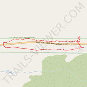
Name: Vallecito loop trail trail, distance, elevation, map, profile, GPS track
Coordinates: 32.97549 -116.36134 32.97712 -116.34973
Thank you for supporting this site ❤️
Make a donation
Make a donation
Gear up for your next adventure:
As an Amazon Associate, this site earns from qualifying purchases at no extra cost to you.