Vertical Competition
- Distance: 5.8 mi
- Elevation gain: 594 m
- Maximum elevation: 508 m
- Elevation loss: 558 m
- Minimum elevation: 455 m
- Moving time: 59 m 58 s
- Moving speed: 5.8 mph
- Maximum speed: 13.9 mph
- Total time: 59 m 58 s
- Global speed: 5.8 mph
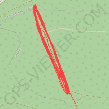
Interactive trail map
Trail profile
- Distance: 5.8 mi
- Elevation gain: 594 m
- Maximum elevation: 508 m
- Elevation loss: 558 m
- Minimum elevation: 455 m
- Moving time: 59 m 58 s
- Moving speed: 5.8 mph
- Maximum speed: 13.9 mph
- Total time: 59 m 58 s
- Global speed: 5.8 mph
About this trail
Name: Vertical Competition trail, distance, elevation, map, profile, GPS track
Coordinates: 48.66135 9.02313 48.66479 9.02538
Other hiking, mountain biking, running and outdoor activity trails
Click on a trail to view its statistics, map and profile.
Track vom: 2020-06-13 07:00
Germany > North Rhine-Westphalia > Kreis Wesel > Schermbeck
Distance: 422.5 mi • Elevation gain: 5,301 m • Maximum elevation: 921 m
Track vom: 2020-06-27 07:26
Germany > Bavaria > Landkreis Ostallgäu > Halblech
Distance: 427.6 mi • Elevation gain: 4,307 m • Maximum elevation: 911 m
Riethoven naar Oostenrijk
Netherlands > North Brabant > Riethoven > Eind
Distance: 573.0 mi • Elevation gain: 13,629 m • Maximum elevation: 1,897 m
PT23BS1 Kiel → Lörrach
Germany > Schleswig-Holstein > Kiel
Distance: 650.4 mi • Elevation gain: 9,265 m • Maximum elevation: 757 m