Castle Rock (P783, 4995)
- Distance: 20.6 mi
- Elevation gain: 303 m
- Maximum elevation: 1,512 m
- Elevation loss: 303 m
- Minimum elevation: 1,277 m
- Moving time: 9 h 9 m
- Moving speed: 2.3 mph
- Maximum speed: 5.1 mph
- Total time: 10 h 58 m
- Global speed: 1.9 mph
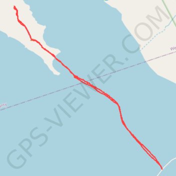
Interactive trail map
Trail profile
- Distance: 20.6 mi
- Elevation gain: 303 m
- Maximum elevation: 1,512 m
- Elevation loss: 303 m
- Minimum elevation: 1,277 m
- Moving time: 9 h 9 m
- Moving speed: 2.3 mph
- Maximum speed: 5.1 mph
- Total time: 10 h 58 m
- Global speed: 1.9 mph
About this trail
Name: Castle Rock (P783, 4995) trail, distance, elevation, map, profile, GPS track
Start: West Davis County Causeway, Davis County, Utah, United States (41.07414 -112.22263)
End: West Davis County Causeway, Davis County, Utah, United States (41.07422 -112.22272)
Coordinates: 41.07414 -112.34476 41.17501 -112.22263