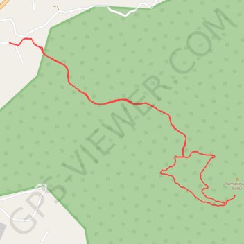
Trail Planner Map
- Distance: 2.8 mi
- Elevation gain: 352 m
- Maximum elevation: 1,176 m
- Elevation loss: 352 m
- Minimum elevation: 860 m
Interactive trail map
Trail profile
- Distance: 2.8 mi
- Elevation gain: 352 m
- Maximum elevation: 1,176 m
- Elevation loss: 352 m
- Minimum elevation: 860 m
About this trail
Name: Trail Planner Map trail, distance, elevation, map, profile, GPS track
Start: Tumakuru, Tumkur taluk, Tumakuru, Karnataka, 572104, India (13.33073 77.15336)
End: Tumakuru, Tumkur taluk, Tumakuru, Karnataka, 572104, India (13.33073 77.15336)
Coordinates: 13.32225 77.15336 13.33097 77.16545