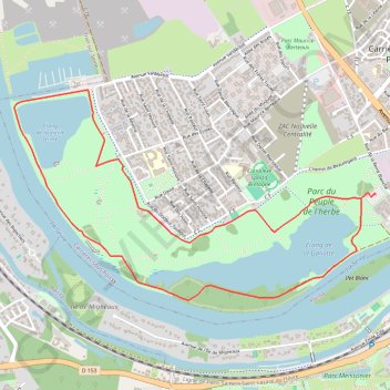
Trail Planner Map
- Distance: 3.7 mi
- Elevation gain: 25 m
- Maximum elevation: 27 m
- Elevation loss: 25 m
- Minimum elevation: 20 m
Interactive trail map
Trail profile
- Distance: 3.7 mi
- Elevation gain: 25 m
- Maximum elevation: 27 m
- Elevation loss: 25 m
- Minimum elevation: 20 m
About this trail
Name: Trail Planner Map trail, distance, elevation, map, profile, GPS track
Coordinates: 48.93138 2.00487 48.94195 2.03244
Other hiking, mountain biking, running and outdoor activity trails
Click on a trail to view its statistics, map and profile.
Paris - Mantes-la-Jolie
France > Ile-de-France > Hauts-de-Seine > Boulogne-Billancourt > Jardin de la Mairie
Distance: 32.3 mi • Elevation gain: 524 m • Maximum elevation: 186 m