Rondje ATB
- Distance: 38.3 mi
- Elevation gain: 84 m
- Maximum elevation: 19 m
- Elevation loss: 84 m
- Minimum elevation: 3 m
Interactive trail map
Trail profile
- Distance: 38.3 mi
- Elevation gain: 84 m
- Maximum elevation: 19 m
- Elevation loss: 84 m
- Minimum elevation: 3 m
About this trail
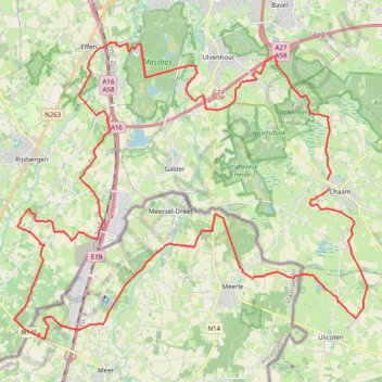
Name: Rondje ATB trail, distance, elevation, map, profile, GPS track
Coordinates: 51.45710 4.69142 51.55330 4.87553
Other hiking, mountain biking, running and outdoor activity trails
Click on a trail to view its statistics, map and profile.
Huijbergen Classic B Rouleurs 107km
Netherlands > North Brabant > Ulvenhout
Distance: 66.6 mi • Elevation gain: 173 m • Maximum elevation: 21 m
Eurovelo 15 - Strasbourg Rotterdam
France > Grand Est > Bas-Rhin > Strasbourg
Distance: 554.1 mi • Elevation gain: 2,104 m • Maximum elevation: 146 m