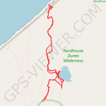
Nordhouse Dunes Wilderness hike
- Distance: 5.8 mi
- Elevation gain: 106 m
- Maximum elevation: 215 m
- Elevation loss: 105 m
- Minimum elevation: 177 m
- Moving time: 3 h 11 m
- Moving speed: 1.8 mph
- Maximum speed: 7.4 mph
- Total time: 3 h 59 m
- Global speed: 1.5 mph
Interactive trail map
Trail profile
- Distance: 5.8 mi
- Elevation gain: 106 m
- Maximum elevation: 215 m
- Elevation loss: 105 m
- Minimum elevation: 177 m
- Moving time: 3 h 11 m
- Moving speed: 1.8 mph
- Maximum speed: 7.4 mph
- Total time: 3 h 59 m
- Global speed: 1.5 mph
About this trail
Name: Nordhouse Dunes Wilderness hike trail, distance, elevation, map, profile, GPS track
Coordinates: 44.08714 -86.44516 44.10895 -86.43819