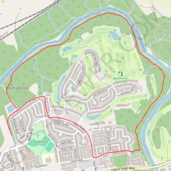
Thames Valley Trail Loop
Interactive trail map
Trail profile
- Distance: 4.3 mi
- Elevation gain: 96 m
- Maximum elevation: 271 m
- Elevation loss: 90 m
- Minimum elevation: 221 m
About this trail
Name: Thames Valley Trail Loop trail, distance, elevation, map, profile, GPS track
Start: Kains Woods, London, Ontario, N6K 0B4, Canada (42.97525 -81.36775)
End: Riverbend Road, London, Ontario, N6K 0B4, Canada (42.97208 -81.36857)
Coordinates: 42.96947 -81.36938 42.98622 -81.34432