Import a GPX file

Hobart Mills - Overland trail - Exploration

Tahoe National Forest
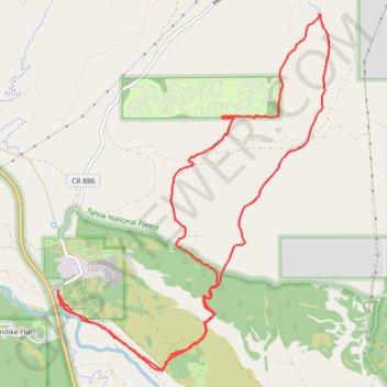
  • Distance: 8.6 mi
  • Elevation gain: 267 m
  • Maximum elevation: 1,944 m
  • Elevation loss: 269 m
  • Minimum elevation: 1,762 m

Interactive trail map

Trail profile

  • Distance: 8.6 mi
  • Elevation gain: 267 m
  • Maximum elevation: 1,944 m
  • Elevation loss: 269 m
  • Minimum elevation: 1,762 m

About this trail

Name: Hobart Mills - Overland trail - Exploration trail, distance, elevation, map, profile, GPS track

Start: Hobart Mills Road, Klondike Flat, Hobart Mills, Nevada County, California, United States (39.39836 -120.18702)

End: Hobart Mills Road, Klondike Flat, Hobart Mills, Nevada County, California, United States (39.39804 -120.18686)

Coordinates: 39.39091 -120.18702 39.42355 -120.15489

Gear up for your next adventure:

📻Hand-Crank Emergency Radios - Stay updated on weather warnings in remote areas
🚶Walking Pedometers - Simple distance tracking for casual trail walkers
📱Phone Mounts for Hiking - Secure mounts to carry your phone on trails
🧭Orienteering Compasses - Accurate compasses for map-based navigation
🔥Emergency Fire Starters - Reliable ignition tools for survival situations in damp conditions

As an Amazon Associate, this site earns from qualifying purchases at no extra cost to you.