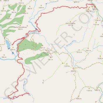
Import a GPX file

Rio Verde

  • Distance: 4.4 mi
  • Elevation gain: 301 m
  • Maximum elevation: 1,080 m
  • Elevation loss: 795 m
  • Minimum elevation: 581 m

Interactive trail map

Trail profile

  • Distance: 4.4 mi
  • Elevation gain: 301 m
  • Maximum elevation: 1,080 m
  • Elevation loss: 795 m
  • Minimum elevation: 581 m

About this trail

Gear up for your next adventure:

🧦Merino Wool Hiking Socks - Moisture-wicking socks to prevent blisters during long mountain walks
🛌Sleeping Mats - Insulated mats for comfortable outdoor sleeping
🕶️Glacier Goggles - Maximum protection for high-altitude snow topography
🥫Expedition Meals - Lightweight, high-calorie nutrition for long-distance hikers
GPS Outdoor Watches - Watches with GPS tracking for hiking and exploration

As an Amazon Associate, this site earns from qualifying purchases at no extra cost to you.