LGT : Bulat-Paetivien : le Circuit des Brigants
- Distance: 6.7 mi
- Elevation gain: 173 m
- Maximum elevation: 290 m
- Elevation loss: 173 m
- Minimum elevation: 230 m
- Moving time: 2 h 37 m
- Moving speed: 2.5 mph
- Maximum speed: 4.1 mph
- Total time: 2 h 51 m
- Global speed: 2.3 mph
Interactive trail map
Trail profile
- Distance: 6.7 mi
- Elevation gain: 173 m
- Maximum elevation: 290 m
- Elevation loss: 173 m
- Minimum elevation: 230 m
- Moving time: 2 h 37 m
- Moving speed: 2.5 mph
- Maximum speed: 4.1 mph
- Total time: 2 h 51 m
- Global speed: 2.3 mph
About this trail
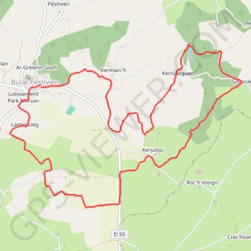
Name: LGT : Bulat-Paetivien : le Circuit des Brigants trail, distance, elevation, map, profile, GPS track
Coordinates: 48.41535 -3.33437 48.43300 -3.29664