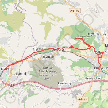
Pencoed - Brynna Woods - Llanharan - Llantrisant Forest - Talbot Green - Pontyclun
Lunch Walk
- Distance: 9.9 mi
- Elevation gain: 328 m
- Maximum elevation: 258 m
- Elevation loss: 318 m
- Minimum elevation: 35 m
- Moving time: 3 h 39 m
- Moving speed: 2.7 mph
- Maximum speed: 13.6 mph
- Total time: 4 h 10 m
- Global speed: 2.4 mph
Interactive trail map
Trail profile
- Distance: 9.9 mi
- Elevation gain: 328 m
- Maximum elevation: 258 m
- Elevation loss: 318 m
- Minimum elevation: 35 m
- Moving time: 3 h 39 m
- Moving speed: 2.7 mph
- Maximum speed: 13.6 mph
- Total time: 4 h 10 m
- Global speed: 2.4 mph
About this trail
Name: Pencoed - Brynna Woods - Llanharan - Llantrisant Forest - Talbot Green - Pontyclun trail, distance, elevation, map, profile, GPS track
Coordinates: 51.52341 -3.50168 51.54662 -3.38696
Topography: Bridgend County Borough topographic map, elevation, terrain
Other hiking, mountain biking, running and outdoor activity trails
Click on a trail to view its statistics, map and profile.
The Headstock 500
United Kingdom > Wales > Newport > Newport
Distance: 300.4 mi • Elevation gain: 9,616 m • Maximum elevation: 691 m
Treorchy, Cearphilly, Pen y Fan
United Kingdom > Wales > Caerphilly County Borough > Tredegar
Distance: 79.1 mi • Elevation gain: 1,934 m • Maximum elevation: 501 m