Import a GPX file

Fowl Lakes trail

  • Distance: 6.7 mi
  • Elevation gain: 661 m
  • Maximum elevation: 1,771 m
  • Elevation loss: 132 m
  • Minimum elevation: 1,218 m
  • Moving time: 3 h 1 m
  • Moving speed: 2.2 mph
  • Maximum speed: 22.0 mph
  • Total time: 3 h 24 m
  • Global speed: 2.0 mph

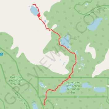
Interactive trail map

Trail profile

  • Distance: 6.7 mi
  • Elevation gain: 661 m
  • Maximum elevation: 1,771 m
  • Elevation loss: 132 m
  • Minimum elevation: 1,218 m
  • Moving time: 3 h 1 m
  • Moving speed: 2.2 mph
  • Maximum speed: 22.0 mph
  • Total time: 3 h 24 m
  • Global speed: 2.0 mph

About this trail

Other hiking, mountain biking, running and outdoor activity trails

Click on a trail to view its statistics, map and profile.

Cheakamus River and Lillooet River

Canada > British Columbia > Squamish-Lillooet Regional District > Area D (Elaho/Garibaldi)

Bikepack from Daisy Lake along Cheakamus River and Lillooet River via Alta Lake, Whistler, Green Lake, Shadow Lake, Nairn Falls, One Mile Lake and Pemberton. #Bike #Nature #River #Lake #Mountain #Forest

Distance: 52.6 mi • Elevation gain: 1,233 m • Maximum elevation: 754 m

Vancouver - Golden

Canada > British Columbia > Metro Vancouver Regional District > Vancouver

#Bike #Vancouver #Golden

Distance: 514.2 mi • Elevation gain: 9,376 m • Maximum elevation: 1,347 m

Gear up for your next adventure:

🧼Biodegradable Soap - Leave-no-trace hygiene for multi-day mountain treks
🌂Windproof Trekking Umbrellas - Surprising but effective rain protection on low-wind trails
📦Compression Sacks - Reduce backpack volume efficiently
🔥Reusable Hand Warmers - Maintain dexterity in your fingers for precise map handling
🧴Sport Sunscreen Sticks - High-protection sunblock that won't run into your eyes on the trail

As an Amazon Associate, this site earns from qualifying purchases at no extra cost to you.