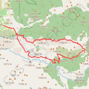
Trevenque
- Distance: 9.5 mi
- Elevation gain: 1,053 m
- Maximum elevation: 2,061 m
- Elevation loss: 977 m
- Minimum elevation: 1,260 m
Interactive trail map
Trail profile
- Distance: 9.5 mi
- Elevation gain: 1,053 m
- Maximum elevation: 2,061 m
- Elevation loss: 977 m
- Minimum elevation: 1,260 m
About this trail
Name: Trevenque trail, distance, elevation, map, profile, GPS track
Coordinates: 37.06662 -3.53310 37.08730 -3.47634
Other hiking, mountain biking, running and outdoor activity trails
Click on a trail to view its statistics, map and profile.
Southern section — European Divide Trail
France > Auvergne-Rhône-Alpes > Drôme > Valence
Distance: 1,506.1 mi • Elevation gain: 42,375 m • Maximum elevation: 2,005 m