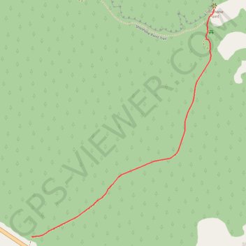
Import a GPX file

Shoshone Point

Hike on the Shoshone Point Trail in the Grand Canyon National Park. #Hiking #Canyon #Forest #Nature

  • Distance: 1.0 mi
  • Elevation gain: 26 m
  • Maximum elevation: 2,224 m
  • Elevation loss: 41 m
  • Minimum elevation: 2,185 m

Interactive trail map

Trail profile

  • Distance: 1.0 mi
  • Elevation gain: 26 m
  • Maximum elevation: 2,224 m
  • Elevation loss: 41 m
  • Minimum elevation: 2,185 m

About this trail

Name: Shoshone Point trail, distance, elevation, map, profile, GPS track

Start: East Rim Drive, Coconino County, Arizona, United States (36.03539 -112.06911)

End: Shoshone Point Trail, Coconino County, Arizona, United States (36.04556 -112.05901)

Coordinates: 36.03539 -112.06911 36.04556 -112.05901

Gear up for your next adventure:

🥾Women's Waterproof Hiking Boots - High-performance trekking boots designed for all-weather comfort
🧭Professional Hiking Compasses - High-precision liquid-filled compasses for map reading and orientation
📱Rugged Phone Cases - Heavy-duty protection for smartphones used as secondary GPS tools
🧤Hiking Gloves - Warm and durable gloves for cold-weather walks
📱Phone Mounts for Hiking - Secure mounts to carry your phone on trails

As an Amazon Associate, this site earns from qualifying purchases at no extra cost to you.