Castle Rock
Porongurup National Park. #Hiking #Porongurup
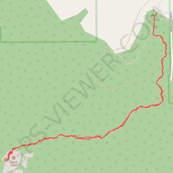
- Distance: 2.6 mi
- Elevation gain: 249 m
- Maximum elevation: 549 m
- Elevation loss: 268 m
- Minimum elevation: 287 m
- Moving time: 1 h 25 m
- Moving speed: 1.8 mph
- Maximum speed: 4.3 mph
- Total time: 1 h 36 m
- Global speed: 1.6 mph
Interactive trail map
Trail profile
- Distance: 2.6 mi
- Elevation gain: 249 m
- Maximum elevation: 549 m
- Elevation loss: 268 m
- Minimum elevation: 287 m
- Moving time: 1 h 25 m
- Moving speed: 1.8 mph
- Maximum speed: 4.3 mph
- Total time: 1 h 36 m
- Global speed: 1.6 mph
About this trail
Name: Castle Rock trail, distance, elevation, map, profile, GPS track
Coordinates: -34.69586 117.91979 -34.68644 117.93215