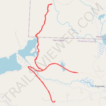
Thank you for supporting this site ❤️
Make a donation
Make a donation
Gear up for your next adventure:
As an Amazon Associate, this site earns from qualifying purchases at no extra cost to you.
North Pond Trail
- Distance: 6.7 mi
- Elevation gain: 146 m
- Maximum elevation: 404 m
- Elevation loss: 146 m
- Minimum elevation: 340 m
- Moving time: 1 h 7 m
- Moving speed: 5.9 mph
- Maximum speed: 9.1 mph
- Total time: 1 h 9 m
- Global speed: 5.7 mph
Interactive trail map
Thank you for supporting this site ❤️
Make a donation
Make a donation
Gear up for your next adventure:
As an Amazon Associate, this site earns from qualifying purchases at no extra cost to you.
Trail profile
- Distance: 6.7 mi
- Elevation gain: 146 m
- Maximum elevation: 404 m
- Elevation loss: 146 m
- Minimum elevation: 340 m
- Moving time: 1 h 7 m
- Moving speed: 5.9 mph
- Maximum speed: 9.1 mph
- Total time: 1 h 9 m
- Global speed: 5.7 mph
Thank you for supporting this site ❤️
Make a donation
Make a donation
Gear up for your next adventure:
As an Amazon Associate, this site earns from qualifying purchases at no extra cost to you.
About this trail
Name: North Pond Trail trail, distance, elevation, map, profile, GPS track
Coordinates: 42.92790 -72.06229 42.95331 -72.04466
Thank you for supporting this site ❤️
Make a donation
Make a donation
Gear up for your next adventure:
As an Amazon Associate, this site earns from qualifying purchases at no extra cost to you.