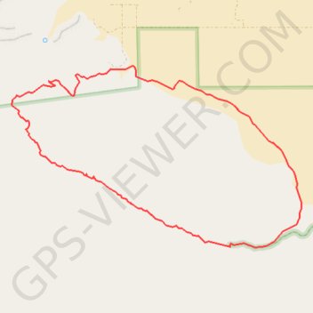
Glorietta Canyon Loop
Loop hike around Glorietta Canyon in the Anza-Borrego Desert State Wilderness. #Hiking #Loop #Canyon #Desert #Nature #Wilderness
- Distance: 7.0 mi
- Elevation gain: 503 m
- Maximum elevation: 729 m
- Elevation loss: 503 m
- Minimum elevation: 262 m
- Moving time: 4 h 16 m
- Moving speed: 1.6 mph
- Maximum speed: 2.8 mph
- Total time: 4 h 28 m
- Global speed: 1.6 mph
Interactive trail map
Trail profile
- Distance: 7.0 mi
- Elevation gain: 503 m
- Maximum elevation: 729 m
- Elevation loss: 503 m
- Minimum elevation: 262 m
- Moving time: 4 h 16 m
- Moving speed: 1.6 mph
- Maximum speed: 2.8 mph
- Total time: 4 h 28 m
- Global speed: 1.6 mph
About this trail
Name: Glorietta Canyon Loop trail, distance, elevation, map, profile, GPS track
Start: Glorietta Canyon, San Diego County, California, 92004, United States (33.18780 -116.38643)
End: Glorietta Canyon, San Diego County, California, 92004, United States (33.18780 -116.38643)
Coordinates: 33.18732 -116.41776 33.20909 -116.37628