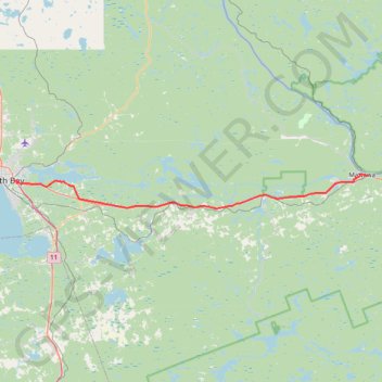
Import a GPX file

North Bay - Mattawa

#Bike #NorthBay #Mattawa

  • Distance: 39.4 mi
  • Elevation gain: 455 m
  • Maximum elevation: 272 m
  • Elevation loss: 513 m
  • Minimum elevation: 147 m

Interactive trail map

Trail profile

  • Distance: 39.4 mi
  • Elevation gain: 455 m
  • Maximum elevation: 272 m
  • Elevation loss: 513 m
  • Minimum elevation: 147 m

About this trail

Other hiking, mountain biking, running and outdoor activity trails

Click on a trail to view its statistics, map and profile.

Québec - Montréal - Saint-Laurent River - Lake Ontario - Niagara Falls

Canada > Quebec > Urban agglomeration of Québec > Quebec

#Bike #Ontario

Distance: 670.1 mi • Elevation gain: 4,804 m • Maximum elevation: 209 m

West Nipissing - North Bay

Canada > Ontario > Nipissing District > Cache Bay

Lake Nipissing. #Bike #Nipissing #NorthBay

Distance: 28.9 mi • Elevation gain: 190 m • Maximum elevation: 238 m

Mattawa - Stonecliffe

Canada > Ontario > Nipissing District > Mattawa

#Bike #Mattawa #Stonecliffe

Distance: 45.8 mi • Elevation gain: 903 m • Maximum elevation: 318 m

Gear up for your next adventure:

🎒Hiking Child Carriers - Explore the outdoors with the whole family safely
🧼Technical Clothing Wash - Special soap to clean and restore waterproof membranes
📸Action Camera Chest Mounts - Record your ascent following topographic paths hands-free
Camping Shelters - Emergency and lightweight shelters for outdoor use
🧊Personal Water Filters - Drink safely from mountain streams marked on your map

As an Amazon Associate, this site earns from qualifying purchases at no extra cost to you.