Pinhoti Trail and Cave Creek Trail Loop via Hernandez Peak and McDill Point
The Pinhoti Trail and Cave Creek Trail Loop offers a rewarding experience in Cheaha State Park, showcasing the beauty of the Talladega Mountains with striking vistas from McDill Point and Hernandez Peak. The trail winds through lush forests, offering peaceful creek crossings and the chance to witness wildlife, while also providing panoramic views of the surrounding valleys and ridges. #Hiking #Loop #Mountain #River #Forest #Nature
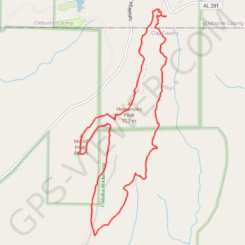
- Distance: 7.0 mi
- Elevation gain: 330 m
- Maximum elevation: 702 m
- Elevation loss: 330 m
- Minimum elevation: 568 m
- Moving time: 2 h 55 m
- Moving speed: 2.4 mph
- Maximum speed: 3.7 mph
- Total time: 3 h 30 m
- Global speed: 2.0 mph
Interactive trail map
Trail profile
- Distance: 7.0 mi
- Elevation gain: 330 m
- Maximum elevation: 702 m
- Elevation loss: 330 m
- Minimum elevation: 568 m
- Moving time: 2 h 55 m
- Moving speed: 2.4 mph
- Maximum speed: 3.7 mph
- Total time: 3 h 30 m
- Global speed: 2.0 mph
About this trail
Name: Pinhoti Trail and Cave Creek Trail Loop via Hernandez Peak and McDill Point trail, distance, elevation, map, profile, GPS track
Start: Cave Creek Trail, Cleburne County, Alabama, United States (33.47107 -85.80673)
End: Cave Creek Trail, Cleburne County, Alabama, United States (33.47106 -85.80674)
Coordinates: 33.43928 -85.82203 33.47207 -85.80671