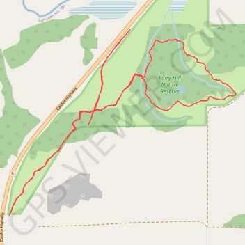
Fairy Hill Nature Reserve
- Distance: 4.8 mi
- Elevation gain: 193 m
- Maximum elevation: 590 m
- Elevation loss: 193 m
- Minimum elevation: 501 m
- Moving time: 1 h 39 m
- Moving speed: 2.9 mph
- Maximum speed: 6.2 mph
- Total time: 1 h 48 m
- Global speed: 2.6 mph
Interactive trail map
Trail profile
- Distance: 4.8 mi
- Elevation gain: 193 m
- Maximum elevation: 590 m
- Elevation loss: 193 m
- Minimum elevation: 501 m
- Moving time: 1 h 39 m
- Moving speed: 2.9 mph
- Maximum speed: 6.2 mph
- Total time: 1 h 48 m
- Global speed: 2.6 mph
About this trail
Name: Fairy Hill Nature Reserve trail, distance, elevation, map, profile, GPS track
Start: Fairy Hill Interpretive Trail, Lumsden No. 189, Saskatchewan, Canada (50.77648 -104.61558)
Coordinates: 50.77642 -104.61559 50.78976 -104.58995