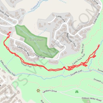
Import a GPX file

Sunset Trail Hike

Oakland Walking #Hiking #Walking #Trail

  • Distance: 1.6 mi
  • Elevation gain: 110 m
  • Maximum elevation: 342 m
  • Elevation loss: 102 m
  • Minimum elevation: 261 m
  • Moving time: 35 m 39 s
  • Moving speed: 2.6 mph
  • Maximum speed: 9.2 mph
  • Total time: 40 m 14 s
  • Global speed: 2.3 mph

Interactive trail map

Trail profile

  • Distance: 1.6 mi
  • Elevation gain: 110 m
  • Maximum elevation: 342 m
  • Elevation loss: 102 m
  • Minimum elevation: 261 m
  • Moving time: 35 m 39 s
  • Moving speed: 2.6 mph
  • Maximum speed: 9.2 mph
  • Total time: 40 m 14 s
  • Global speed: 2.3 mph

About this trail

Gear up for your next adventure:

👕Merino Base Layers - Natural temperature regulation for cold weather hiking and camping
📢Survival Whistles - Essential safety gear for signaling for help in mountain fog
🧢Waterproof Hiking Hats - Keep the rain off your face while studying topographic maps
🛰️Satellite Messengers - Emergency communication devices for areas without mobile signal
🥤Hydration Bladders - Hands-free hydration systems for backpacks

As an Amazon Associate, this site earns from qualifying purchases at no extra cost to you.