Balsfjord Ski de randonnée nordique/Surf des neiges
- Distance: 6.3 mi
- Elevation gain: 1,160 m
- Maximum elevation: 1,172 m
- Elevation loss: 1,172 m
- Minimum elevation: 21 m
- Moving time: 2 h 18 m
- Moving speed: 2.7 mph
- Maximum speed: 35.8 mph
- Total time: 3 h 22 m
- Global speed: 1.9 mph
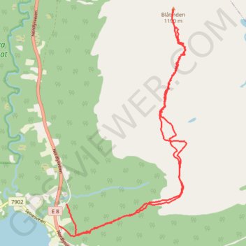
Interactive trail map
Trail profile
- Distance: 6.3 mi
- Elevation gain: 1,160 m
- Maximum elevation: 1,172 m
- Elevation loss: 1,172 m
- Minimum elevation: 21 m
- Moving time: 2 h 18 m
- Moving speed: 2.7 mph
- Maximum speed: 35.8 mph
- Total time: 3 h 22 m
- Global speed: 1.9 mph
About this trail
Name: Balsfjord Ski de randonnée nordique/Surf des neiges trail, distance, elevation, map, profile, GPS track
Start: Ørnesveien, Ytre Laksvatn, Laksvatn, Balsfjord, Troms, Norway (69.38112 19.28844)
End: 26, Ørnesveien, Ytre Laksvatn, Laksvatn, Balsfjord, Troms, 9042, Norway (69.37861 19.28603)
Coordinates: 69.37739 19.28603 69.40332 19.32718