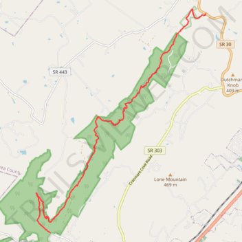
Cumberland Trail Graysville Mountain Trail
- Distance: 9.4 mi
- Elevation gain: 695 m
- Maximum elevation: 545 m
- Elevation loss: 466 m
- Minimum elevation: 268 m
- Moving time: 3 h 49 m
- Moving speed: 2.5 mph
- Maximum speed: 5.0 mph
- Total time: 4 h 55 m
- Global speed: 1.9 mph
Interactive trail map
Trail profile
- Distance: 9.4 mi
- Elevation gain: 695 m
- Maximum elevation: 545 m
- Elevation loss: 466 m
- Minimum elevation: 268 m
- Moving time: 3 h 49 m
- Moving speed: 2.5 mph
- Maximum speed: 5.0 mph
- Total time: 4 h 55 m
- Global speed: 1.9 mph
About this trail
Name: Cumberland Trail Graysville Mountain Trail trail, distance, elevation, map, profile, GPS track
Coordinates: 35.45926 -85.11037 35.52722 -85.04704