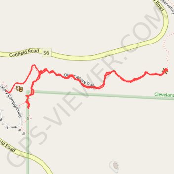
Palomar trail, first part
- Distance: 1.3 mi
- Elevation gain: 74 m
- Maximum elevation: 1,527 m
- Elevation loss: 92 m
- Minimum elevation: 1,481 m
- Moving time: 29 m 23 s
- Moving speed: 2.6 mph
- Maximum speed: 6.0 mph
- Total time: 41 m 13 s
- Global speed: 1.9 mph
Interactive trail map
Trail profile
- Distance: 1.3 mi
- Elevation gain: 74 m
- Maximum elevation: 1,527 m
- Elevation loss: 92 m
- Minimum elevation: 1,481 m
- Moving time: 29 m 23 s
- Moving speed: 2.6 mph
- Maximum speed: 6.0 mph
- Total time: 41 m 13 s
- Global speed: 1.9 mph
About this trail
Name: Palomar trail, first part trail, distance, elevation, map, profile, GPS track
Start: Observatory Trail, San Diego County, California, 92060, United States (33.34395 -116.87604)
Coordinates: 33.34246 -116.87764 33.34416 -116.87015
Other hiking, mountain biking, running and outdoor activity trails
Click on a trail to view its statistics, map and profile.